Caminito del Rey
The history of Caminito del Rey: from hydroelectric installation to tourist attraction
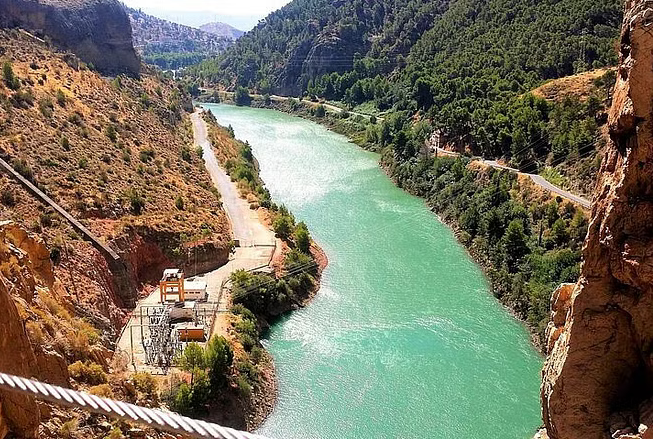
Running through the municipalities of Ardales, Álora and Antequera, the Caminito del Rey has a curious history which has nothing to do with tourism and dates back to the early twentieth century. This was when the Sociedad Hidroeléctrica del Chorro, owner of the Gaitanejo and the El Chorro power stations, decided to build a water canal that would unite them within a hydroelectric power plant, taking advantage of the unevenness of the land. The project included a maintenance path that linked both ends of the hydroelectric station, which would be used by company operators much earlier than tourists. The works finished in 1905, but as the path was so beautiful—it was already attracting numerous visits—the chief engineer Rafael Benjumea decided to improve the layout and the bridge that joined both ends of the gorge, known as Balconcillo de los Gaitanes. In 1921, the path received the name of Caminito del Rey after it was inaugurated by the monarch Alfonso XIII, as attested by several images from the time.
With the passing of the years, the path fell into a state of disrepair that ended with some sections collapsing and the railing along almost the entire route disappeared. This was how it earned its reputation as “the most dangerous path in the world”, and it attracted adventurous hikers unaware of the risks. In 2001, after four fatal accidents in just two years, the authorities closed all access roads to it.
It was not, however, the death of the Caminito del Rey. On 28 March 2015, after one year of restoration work and five million euros’ public investment, the path was reopened to the public, and quickly became one of the most attractive destinations in the world and a great driver of tourism in the region. In 2019, its candidacy for UNESCO World Heritage recognition was submitted.
The Caminito del Rey Path: 8 Kilometres of adrenaline
The route begins in the municipality of Ardales, in the El Kiosko restaurant reception area—where the tickets are bought and a safety helmet is given. From here the journey descends downhill for 8 kilometres until arriving at the El Chorro station, in the municipality of Álora. It can be completed in approximately three or four hours. There are two access routes to the Caminito del Rey footbridges: the Senda de Gaitanejo, a 2.7-kilometre, narrow path that runs between pine trees, and a shorter one that takes the adventurer through a narrow pedestrian tunnel and the Pista de Gaitanejo (1.5 kilometres).
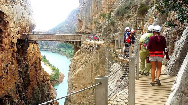
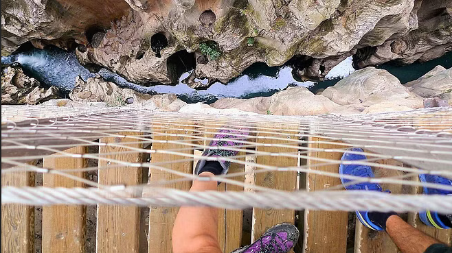
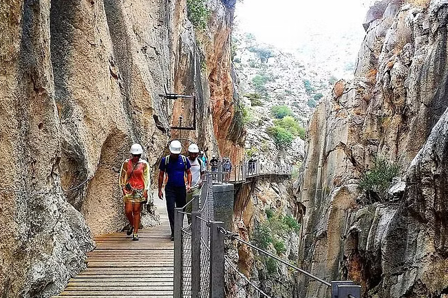
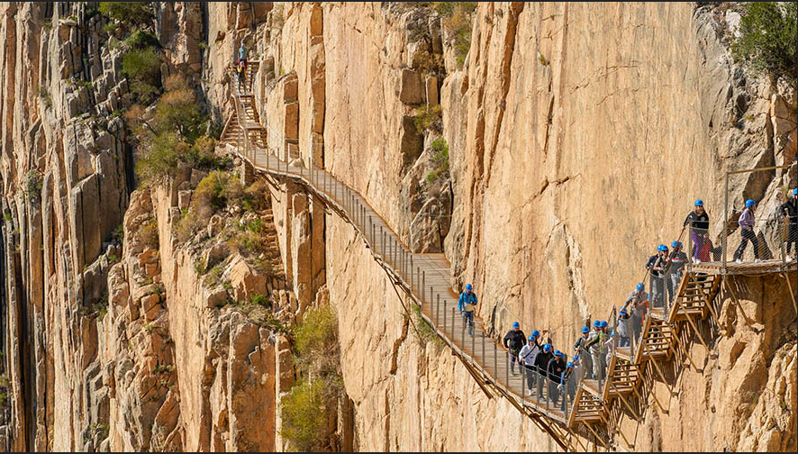
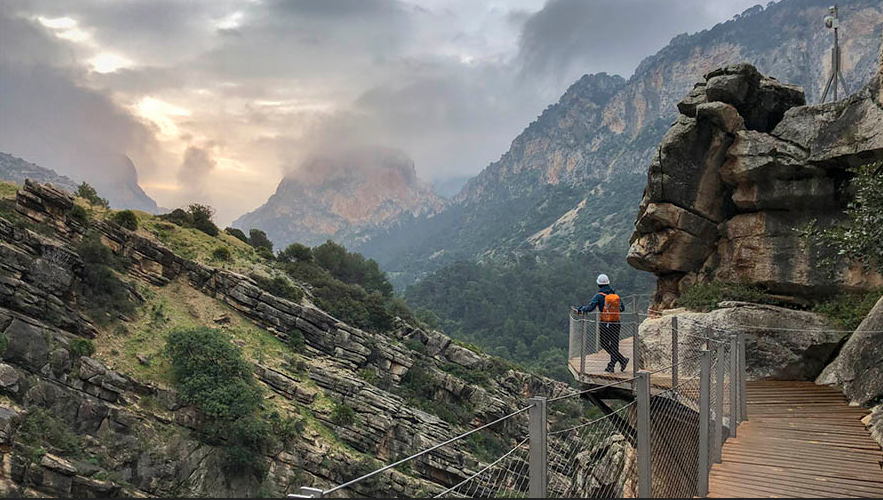
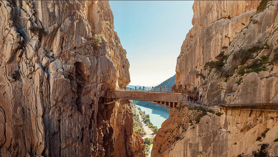
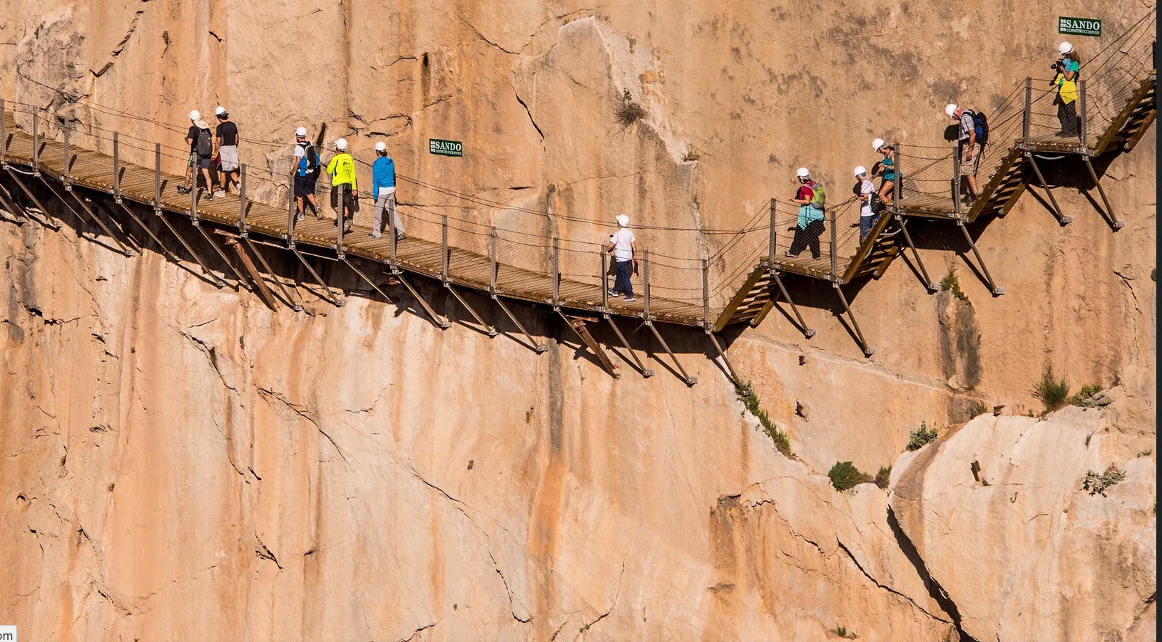
Both converge at the Visitor Reception Booth, where the official route begins next to the former Electrical Substation. We will walk along three kilometres of dizzily high footbridges, through old hydroelectric infrastructure. Plaques marking the maximum levels reached by the water, during floods in 1941 and 1949 can be seen on the rock wall. We will pass up to three canyons: the Desfiladero de Gaitanejo, just 10 metres wide; the Tajo de las Palomas, where we will have to walk over the abyss by crossing the Puente del Rey bridge and cross several lookouts; and the Desfiladero de los Gaitanes, the most breathtaking stretch of the route, with narrow walkways literally hanging from the cliff and the famous Hanging Bridge, 105 metres above the Guadalhorce river.
The last section of the route, the Avenida Caminito del Rey, is a 2.1-kilometre downhill path that takes us to the El Chorro railway station after passing through the old town of El Chorro, where workers who built the canal and, later, the operators of the hydroelectric plant and their families, used to live.
Important Recommendations
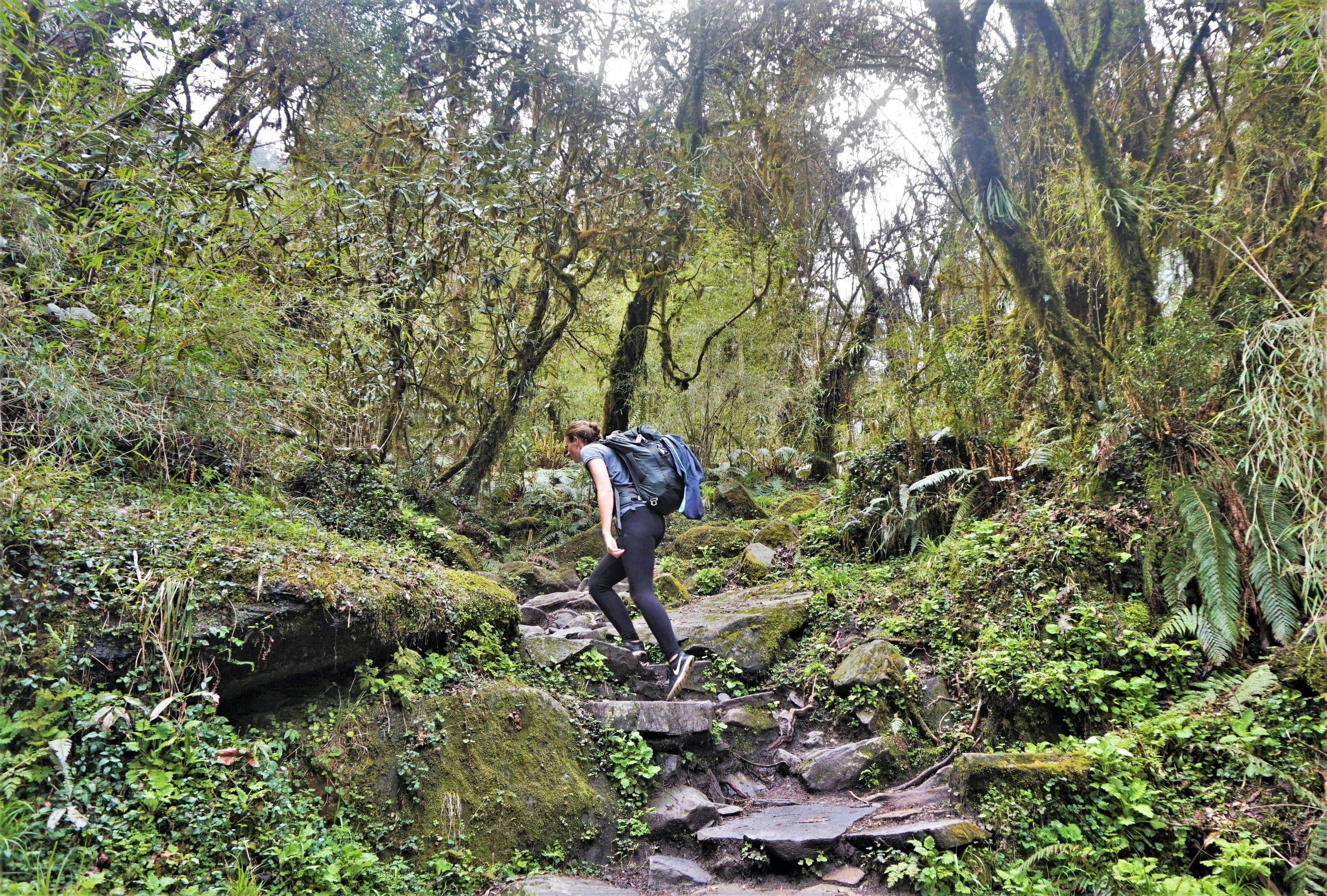
Walking the Caminito del Rey involves approximately four hours of considerable physical effort, so we recommend that you plan your excursion well. Comfortable clothing and hiking footwear are essential, as well as water, food and sunscreen in summer. There are no bathrooms along the route, so bear this in mind when you are in the visitor reception area. This route is not recommended for people who have a low fitness level or issues with heights.
Finally, it should be noted that this is a linear, not a circular path, so visitors will need to return to the starting point by their own means (there is a shuttle bus service between the north access—Ardales—and the south accesses—El Chorro, Álora).
HEAD OFFICE
575 Madison Ave, New York, NY 10022, United States